About EAPs
New Inundation Mapping Technology
Helps IEAP
Development
NEW FROM FEMA
Federal Guidelines for Inundation Mapping of Flood Risks Associated with Dam Incidents and Failures
 This 145-page document is informative for dam owners, emergency managers, and the public regarding the importance of inundation mapping as part of a comprehensive Emergency Action Plan. It provides dam safety professionals with guidance on how to prepare dam breach inundation modeling studies and conduct mapping that can be used for multiple purposes, including dam safety, hazard mitigation, consequence evaluation, and emergency management including developing EAPs. This guidance is intended to provide a consistent approach that can be applied across the nation.
Knowing where a HHP dam is located that may impact your home, business, or favorite recreational area is important. But knowing the boundaries of the 'hazard area' also is important. This information may not be clearly defined unless there is an IEAP for that dam. A thorough IEAP will include an 'inundation map' that shows the hazard area.
An inundation map will vary in detail and content according to the characteristics of the hazard area. For unincorporated areas, the map shows county, state, and federal roads, and houses, buildings, and other features. Often the map for the affected counties can be taken from county highway maps usually published by the state's Department of Transportation. If the map includes incorporated areas, it will show streets bounding the inundation zone. In other cases, the inundated area will be sparsely populated so that a narrative describing the areas flooded may be sufficient. Flooding of key points can be established and interpolation can be used to determine if a feature between these points will be flooded. Rate of travel of flooding can be described so that timing can be estimated.
Inundation Mapping Resources
![]() Inundation Maps Make Emergency Action Plans For Dams More Effective
Inundation Maps Make Emergency Action Plans For Dams More Effective
Accurate dam breach analyses and inundation mapping are critical components for constructing useful Incident Emergency Action Plans (IEAPs) within downstream environment zones. Recent national guidance suggests IEAP development as a top priority for all high-hazard dams.
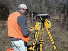
New technology is now providing ways to create inundation maps that are highly accurate and yet do not require weeks of field time by survey crews. High-resolution LiDAR (Light Detection and Ranging) data is being used to enhance breach inundation mapping. A combination of LIDAR and field survey, in conjunction with U.S. Army Corps of Engineers software such as HEC-RAS and GEO-RAS, enable detailed breach analyses.
Inundation mapping of a dam breach is very different from what one may see on the 100-year flood maps for the same area. A dam breach and subsequent flood wave develop over time and flow dynamically through the downstream environment rather than a steady-state backwater calculation. These flood waves may travel very swiftly whereas a flood from heavy rains may rise more slowly. Inundation mapping shows the downstream environment zone structures that are inundated by at least two feet of water during the time of maximum water surface elevation.
It is critical that emergency managers focus their limited resources where they are needed most in the event of a dam failure. The objective of accurate inundation mapping is to facilitate this focus. For this work to be effective, cooperation of the Dam Safety Program, dam owners, emergency responders, and input from the public is necessary.
In some states, inundation mapping is provided by the state dam safety program. In other states, including Indiana, the cost of inundation mapping is more likely to be the responsibility of the dam owner unless grant funds become available from the state or federal agencies such as USDA or FEMA. Public support can be helpful in convincing governmental units of the value that inundation mapping provides in creating high quality IEAPs.
Inundation Map vs. Evacuation Area
Inundation maps are developed from the best available information using reasonable assumptions and standardized methods. They are approximations of the maximum water surface extents resulting from a complete dam breach and draining of the full reservoir. Inundation maps are empirical hydrologic and hydraulic simulations which can only be field verified in the event of an actual breach.
Evacuation areas and emergency call lists based on these maps should take into consideration the anticipated local impacts of flooding, knowledge of local infrastructure, both occupancy and ownership of property, and potential interrupted services or cut-off access caused by a dam failure.