About EAPs
Simplified Inundation Maps (SIMS)
Thorough breach analysis and inundation mapping can be quite expensive, so several states have encouraged dam owners and emergency managers to create Simplified Inundation Maps (SIMS) where appropriate for the dam. SIMS are maps created by identifying potential at-risk structures and roads without a detailed engineering analysis and/or modeling. Photo-based maps are preferred.

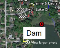
Example dam - a good candidate for SIMS
SIMS are most applicable for:
- Small or medium sized dams with an easily identified number of downstream structures, and where local emergency managers agree that adequate evacuation procedures can be established.
- A small or medium sized dam without funding for engineering studies. SIMS may be used to quickly establish the likely inundation zone until funding can be arranged the mapping updated.

Example dam - a good candidate for SIMS
SIMS do not replace more detailed modeling and analysis that is necessary for:
- Large sized dams
- Dams with large populations in the evacuation area
- Dams with diversion structures, split flows, or potential for "domino-style" cascading failures of dams downstream
- Flood control structures with large amounts of freeboard
SIMS guidance is not meant to displace any state or federal regulatory requirement or the need for detailed inundation mapping for assessment of downstream hazard potential. SIMS may not be used for mapping requirements in the design or rehabilitation of dams.
Aerial photo services that can be helpful in creating a SIMS include Google Earth. Those images, in conjunction with topographical maps of the area around and below the dam, are then used to create the SIMS using assumptions about the breach wave height and distance it will travel (as explained in the guidelines).
