About EAPs
What is a High-Hazard Potential Dam?
Each state has definitions and methods to determine the Hazard Potential of a dam. The Hazard Potential is defined as a situation which creates the potential for consequences such as loss of life, property damage, or other adverse impacts.
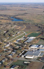
 Neighborhood association dams in suburban communities can be a significant risk to downstream residents and their homes, workers and their businesses, and even those who may be merely passing through the area.

Extensive development downstream from dams in rural areas will increase the risk to lives and property in the event of a dam failure.
These adverse impacts may occur in a defined area downstream of a dam because of flood-waters released through spillways and outlet works of the dam or because of waters released by partial or complete failure of the dam. Adverse impacts also may occur upstream of the dam from effects of backwater flooding or landslides around the reservoir perimeter.
In California, dams are regulated by the Department of Water Resources Division of Safety of Dams (DSOD) based on several factors including the height of the dam and the storage capacity of the reservoir. Federal dams are excluded from state regulation, and some non-federal dams also may be exempt. Currently, approximately 1,250 dams in California fall under state jurisdiction. A list of these dams is on the DSOD website.
DSOD determines the hazard classification of a dam based on the potential consequences resulting from the uncontrolled release of its reservoir contents because of a failure or wrongful operation of the structure. A highly technical set of factors and criteria that are explained on the DSOD website will determine hazard classification. The DSOD website also provides summaries of laws and regulations pertaining to dams.
Inundation maps are a crucial part of a comprehensive EAP, and in California these maps have been created for most large dams. EAPs and inundation mapping of HHP dams are under the jurisdiction of the California Office of Emergency Services (CalOES) Dam Safety Program within the Hazard Mitigation division. California legal code requires dam owners to submit copies of inundation maps developed by civil engineers to the CalOES. Copies of these maps are also provided to the appropriate public safety agency of any city and/or county likely to be affected. Most local agencies overlay these inundation maps onto their land parcel map systems, such as those used by assessors.
CalOES provides a directory of local emergency managers who may be able to help determine if a particular parcel is within an inundation zone. CalOES also provides a MyHazards website that provides a way to zoom in on specific areas and see area hazards, plus planning tools to help create a "preparedness kit" for a home or business.
A Multi-Year Plan to Increase EAPs on HHP Dams
The California Dam Safety Program is implementing a multi-year program to strive for 100% completion of EAPs on HHP dams. This program includes using federal grant funds and state funds, along with state staff and outside experts, to accomplish the following. Several phases have been completed, but several years of work remain before the goal is achieved. The program phases include:
- Coordinate state intra-agency understanding and cooperation on EAPs and inundation mapping
- Contract with a university for research to determine the status of EAPs in the state and any issues or obstacles to EAP completion
- Develop the state's EAP template using FEMA and USDA/NRCS guidelines as models
- Contract with a university to identify helpful technologies to simplify inundation mapping and reduce costs
- Begin completion of inundation maps for dam owners who cannot afford the cost
- Develop and mail letters to all dam owners urging them to complete EAPs, and follow up with dam owners who were not responsive
- Contract with a university for help working with local emergency managers to coordinate EAP development
